Connect with us
We’re experimenting with AI-generated content to help deliver information faster and more efficiently.
While we try to keep things accurate, this content is part of an ongoing experiment and may not always be reliable.
Please double-check important details — we’re not responsible for how the information is used.

Automotive and Transportation

Nimble Dimples: Agile Underwater Vehicles Inspired by Golf Balls

Underwater or aerial vehicles with dimples like golf balls could be more efficient and maneuverable, a new prototype has demonstrated.
Avatar photo

Published

on

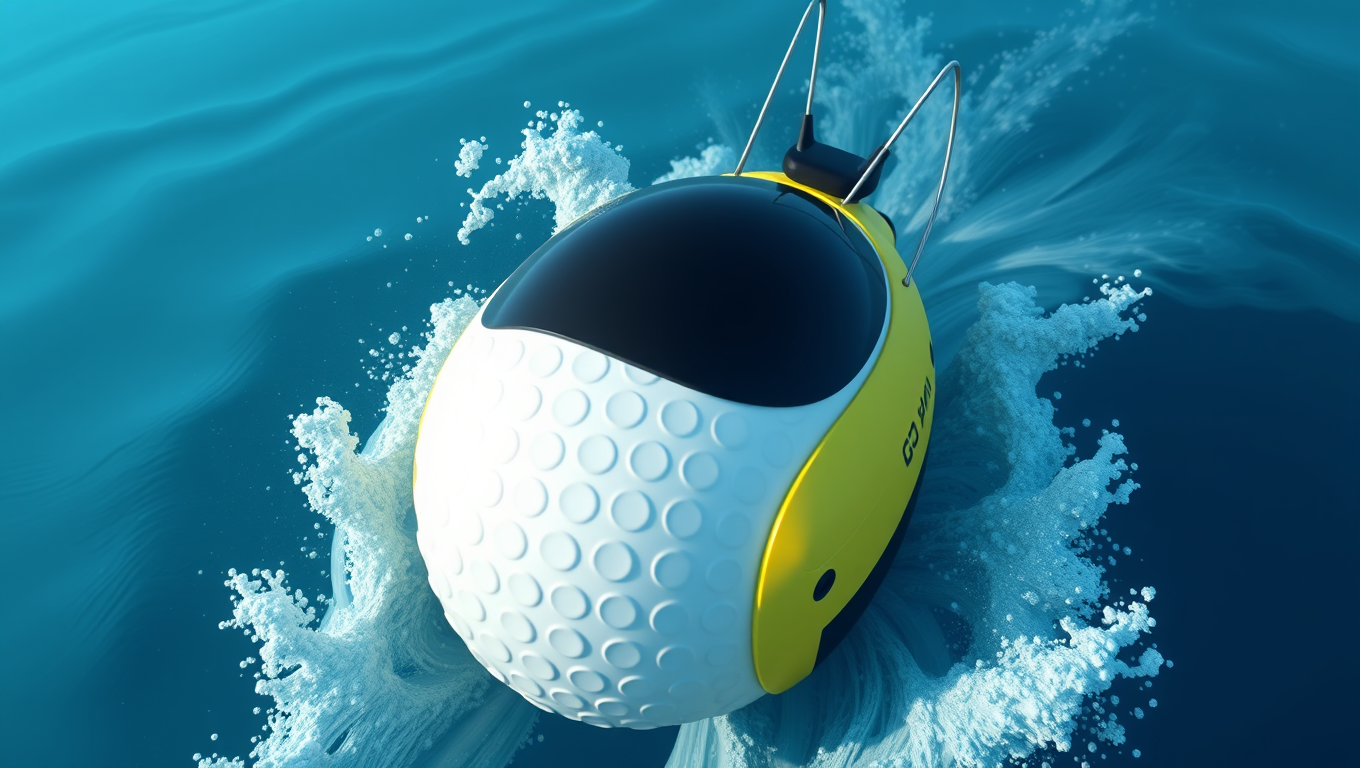
The University of Michigan has developed a groundbreaking prototype that could revolutionize the way we design and navigate underwater vehicles. By taking inspiration from the humble golf ball, researchers have created a spherical prototype with adjustable surface dimples that can drastically reduce drag while eliminating the need for protruding appendages like fins or rudders.

Anchal Sareen, U-M assistant professor of naval architecture and marine engineering, led the research team in developing the smart morphable sphere. The team formed the prototype by stretching a thin layer of latex over a hollow sphere dotted with holes, resembling a pickleball. A vacuum pump depressurizes the core, pulling the latex inwards to create precise dimples when switched on.

To test how the dimples affected drag, the sphere was put through its paces within a 3-meter-long wind tunnel. The researchers found that for high wind speeds, shallower dimples cut the drag more effectively while deeper dimples were more efficient at lower wind speeds. By adjusting dimple depth, the sphere reduced drag by 50% compared to a smooth counterpart for all conditions.

Moreover, the adaptive skin setup was able to notice changes in the speed of the incoming air and adjust dimples accordingly to maintain drag reductions. This concept could be applied to underwater vehicles, reducing both drag and fuel consumption.

The smart morphable sphere can also generate lift, allowing for controlled movement. By designing the inner skeleton with holes on only one side, the researchers created asymmetric flow separation on the two sides of the sphere, deflecting the wake toward the smooth side. This effectively pushed the sphere in the direction of the dimples, enabling precise steering by selectively activating dimples on the desired side.

The team tested the new sphere in the same wind tunnel setup with varying wind velocity and dimple depth. With the optimal dimple depth, the half rough/half smooth sphere generated lift forces up to 80% of the drag force. This is comparable to the Magnus effect, but instead of using rotation, it was created entirely by modifying the surface texture.

The implications of this research are vast and exciting. For example, compact spherical robotic submarines that prioritize maneuverability over speed for exploration and inspection could benefit from this mechanism, reducing the need for multiple propulsion systems.

Anchal Sareen anticipates collaborations that combine expertise in materials science and soft robotics, further advancing the capabilities of this dynamic skin technology. She believes that this smart dynamic skin technology could be a game-changer for unmanned aerial and underwater vehicles, offering a lightweight, energy-efficient, and highly responsive alternative to traditional jointed control surfaces.

Ultimately, this innovation promises to enhance maneuverability, optimize performance, and unlock new possibilities for vehicle design. As researchers continue to explore and refine this technology, we can expect to see significant advancements in the field of underwater vehicles and beyond.

Automotive and Transportation

Satellite Data from Ship Captures Landslide-Generated Tsunami: A Breakthrough in Early Warning Systems

New research demonstrates shipborne navigation systems have potential to improve tsunami detection and warning.

Avatar photo

Published

on

By

Satellite Data from Ship Captures Landslide-Generated Tsunami: A Breakthrough in Early Warning Systems

Landslide-generated tsunamis pose a significant threat to coastal communities, particularly within narrow fjords where tall cliffs can trap and amplify waves. Scientists have traditionally relied on earthquake-based observation systems to issue tsunami warnings, but these methods often fail to capture localized ground movement caused by landslides.

In a groundbreaking study published in Geophysical Research Letters, researchers from the University of Colorado Boulder’s Cooperative Institute for Research in Environmental Sciences (CIRES) and the University of Alaska Fairbanks have successfully detected tsunami waves generated by a landslide using data from a ship’s satellite receiver. This achievement has significant implications for improving early warning systems and saving lives.

On May 8, 2022, a landslide near the port city of Seward, Alaska, sent debris tumbling into Resurrection Bay, creating a series of small tsunami waves. The R/V Sikuliaq, a research ship owned by the National Science Foundation and operated by the University of Alaska Fairbanks, was moored 650 meters (0.4 miles) away from the landslide site. Fortunately, it was equipped with an external Global Navigation Satellite System (GNSS) receiver previously installed by Ethan Roth, the ship’s science operations manager.

Researchers took advantage of this unique opportunity to analyze data from the ship’s GNSS receiver and open-source software to calculate changes in the vertical position of the R/V Sikuliaq down to the centimeter level. They created a time series showing the ship’s height before, during, and after the landslide. By comparing the data to a landslide-tsunami model, they confirmed that the ship’s vertical movement was consistent with the event, marking the first detection of a landslide-generated tsunami from a ship’s satellite navigation system.

This breakthrough has significant implications for early warning systems. As researcher Adam Manaster noted, “If we process the data fast enough, warnings can be sent out to those in the affected area so they can evacuate and get out of harm’s way.” The study builds upon previous CIRES-led research demonstrating how GPS data from commercial shipping vessels could be used to improve tsunami early warning systems.

To implement this approach on a larger scale, researchers emphasize the need for collaboration with the shipping industry to make onboard data accessible to scientists. As researcher Anne Sheehan noted, “The science shows that this approach works. So many ships now have real-time GPS, but if we want to implement on a larger scale, we need to collaborate with the shipping industry.”

Continue Reading

Automotive and Transportation

“Mapping Safer Bike Routes with ProxiCycle: A Small Sensor’s Big Impact”

Researchers have developed a system, called ProxiCycle, that logs when a passing car comes too close to a cyclist (four feet or less). A small, inexpensive sensor plugs into bicycle handlebars and tracks the passes, sending them to the rider’s phone. The team tested the system for two months with 15 cyclists in Seattle and found a significant correlation between the locations of close passes and other indicators of poor safety, such as collisions.

Avatar photo

Published

on

By

The University of Washington-led team has developed a system called ProxiCycle that logs when a passing car comes too close to a cyclist (within four feet). This small, inexpensive sensor plugs into bicycle handlebars and tracks the passes, sending them to the rider’s phone. The team tested the system for two months with 15 cyclists in Seattle and found a significant correlation between the locations of close passes and other indicators of poor safety, such as collisions.

“The threat of cars is the biggest deterrent to cycling,” said lead author Joseph Breda, a UW doctoral student in the Paul G. Allen School of Computer Science & Engineering. “We want to help novice cyclists navigate safer bike routes through cities.”

The team surveyed 389 people in Seattle and found that respondents of all cycling experience levels ranked the threat of cars as the factor which most discouraged them from cycling. They also said they’d be very likely to use a map that helps navigate for safety.

To create ProxiCycle, the team built a small sensor system that plugs into a bike’s left handlebar. The system consists of a 3D printed plastic casing that houses a pair of sensors and a Bluetooth antenna. The antenna transmits data to the rider’s phone, where the team’s algorithm susses out what’s a passing car rather than a person, or another cyclist, or a tree.

The team validated the system both by testing it in a parking lot, with a car passing at different distances, and with seven cyclists riding through Seattle with GoPro cameras on their handlebars. Researchers watched the footage from these rides and compared this to the sensor output.

In the future, researchers hope to scale the study up and potentially account for other risk factors, such as cyclists being hit by opening car doors, and deploy ProxiCylce in other cities. With enough data, existing bike mapping apps might include safer route suggestions for cyclists.

“One study participant found out that there’s a great bike lane on a quieter street just one block north,” said Breda. “It’s these minor adjustments that can make a big difference in safety.”

Continue Reading

Automotive and Transportation

Soft Wire Act: Revolutionary Robot Can Carry Cargo Up and Down Steep Aerial Wires

Researchers have created a light-powered soft robot that can carry loads through the air along established tracks, similar to cable cars or aerial trams. The soft robot operates autonomously, can climb slopes at angles of up to 80 degrees, and can carry loads up to 12 times its weight.

Avatar photo

Published

on

By

In a groundbreaking innovation, researchers have designed a light-powered soft robot that can carry loads through the air along established tracks, similar to cable cars or aerial trams. This autonomous soft robot, made of liquid crystal elastomers, can climb slopes at angles of up to 80 degrees and carry loads up to 12 times its weight.

According to Jie Yin, corresponding author of a paper on the work and an associate professor of mechanical and aerospace engineering at North Carolina State University, “We’ve previously created soft robots that can move quickly through water and across solid ground. Now, we’ve demonstrated that it’s possible to carry objects through the air across open space by following established tracks.”

The soft robot operates by being suspended on a track, which can be as thin as a human hair or as thick as a drinking straw. When exposed to infrared light perpendicular to the track, the portion of the ribbon absorbing the most light contracts, inducing a rolling motion that pulls the “cooler” part into the light. This cycle repeats itself over and over again, causing the soft ring robot to roll and twist on itself as it moves along the track.

“We’ve also shown that our soft ring robot can overcome obstacles on the track, such as knots or bulges,” says Fangjie Qi, first author of the paper and a Ph.D. student at NC State. “It can travel up or down a slope and carry loads more than 12 times its weight.”

In addition to navigating tracks of varying thickness, the researchers demonstrated that the soft robot can follow complex routes, including curved lines, circles, three-dimensional spirals, and so on, in a controlled way.

The team is now exploring specific applications for this technology, as well as adapting the soft robots to respond to inputs other than infrared light. “For example,” says Yin, “we’re thinking about developing a soft ring robot that operates in sunlight or responds to other external energy sources.”

Continue Reading

Trending