Connect with us
We’re experimenting with AI-generated content to help deliver information faster and more efficiently.
While we try to keep things accurate, this content is part of an ongoing experiment and may not always be reliable.
Please double-check important details — we’re not responsible for how the information is used.

Climate

The Hidden Dangers of Clear-Cutting: How a Single Action Can Trigger Catastrophic Floods

Clear-cutting forests doesn’t just raise flood risk — it can supercharge it. UBC researchers found that in certain watersheds, floods became up to 18 times more frequent and over twice as severe after clear-cutting, with these effects lasting more than four decades. The surprise? Terrain details like which direction a slope faces played a huge role in flood behavior. Conventional models miss these dynamics, which could mean we’ve been underestimating the danger for decades — especially as climate change accelerates extreme weather.
Avatar photo

Published

on

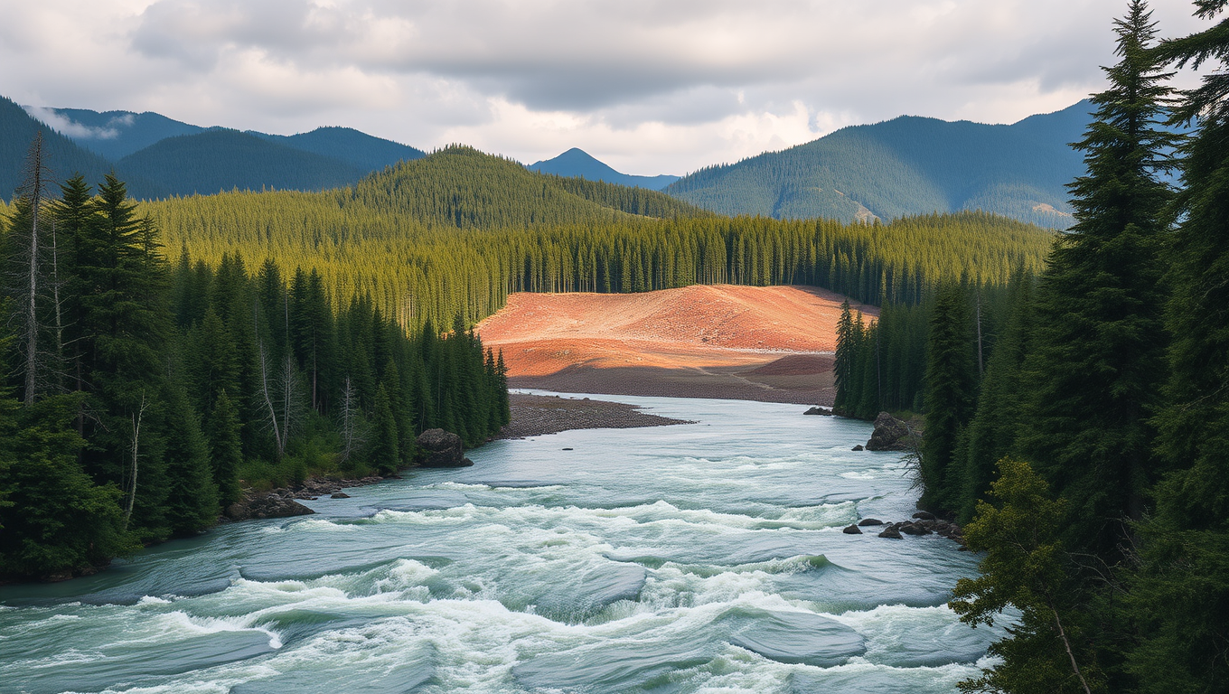
Clear-cutting has long been practiced as a means of forest management, but a new study from the University of British Columbia (UBC) reveals a shocking truth: this seemingly innocuous practice can have catastrophic consequences, including 18 times more frequent floods and effects lasting over 40 years.

The research team analyzed two adjacent watersheds in North Carolina, both clear-cut in the late 1950s. While one watershed showed no significant impact from the treatment, the other experienced four to 18 times more frequent floods, with average flood sizes increasing by 47 percent compared to pre-treatment levels. The biggest floods grew by as much as 105 percent.

This study challenges conventional thinking about forest management’s impact on flooding, according to Dr. Younes Alila, senior author and hydrologist in the UBC faculty of forestry. “We hope the industry and policymakers will take note of the findings, which show that it matters not only how much forest you remove but also where, how, and under what conditions.”

The researchers found that seemingly minor landscape factors, such as the direction a slope faces, can make or break a watershed’s response to treatment. This experimental evidence validates the need for better analysis methods, Dr. Alila added.

Most conventional flood models rely on simplified assumptions, cutting X percent of trees and expecting Y percent more water runoff. However, this study demonstrates that such models fail to account for extreme and erratic flood patterns that emerge after landscape disturbances.

The most concerning finding was that flood effects in the north-facing watershed persisted for over 40 years, confirming that forestry treatments can lead to long-term changes in a watershed’s flood response, especially as climate change brings more extreme weather.

The findings have immediate relevance for forest management practices, particularly in B.C. where there are similar terrain types and forestry operations in the form of clear-cut logging. The model used in this study can be used to predict which parts of B.C. are currently more at risk of extreme flooding and investigate how much of the severity of recent floods can be attributed to global warming and/or land use and forest cover changes.

“Our findings highlight how multiple landscape factors interact in complex ways,” Dr. Alila noted. “As climate conditions shift, understanding those dynamics is becoming increasingly important for forest and water management.”

Atmosphere

Unpacking America’s Winter Puzzle: How the Stratosphere Shapes Extreme Cold Snaps

Even in a warming climate, brutal cold snaps still hammer parts of the U.S., and a new study uncovers why. High above the Arctic, two distinct polar vortex patterns — both distorted and displaced — play a major role in steering icy air toward different regions. One sends it plunging into the Northwest, while the other aims it at the Central and Eastern U.S. Since 2015, the westward version has been more common, bringing intensified cold to the Northwest in defiance of global warming trends. This stratospheric detective work offers fresh insight into extreme winter weather — and could supercharge long-range forecasts.

Avatar photo

Published

on

The United States is no stranger to bone-chilling winter cold, despite a warming climate. A recent study has shed light on why this phenomenon persists, pointing to two specific patterns in the polar vortex – a swirling mass of cold air high in the stratosphere. These variations can steer extreme cold to different regions of the country, often contradicting broader warming trends.

Researchers from an international team, including Prof. Chaim Garfinkel (Hebrew University), Dr. Laurie Agel and Prof. Mathew Barlow (University of Massachusetts), Prof. Judah Cohen (MIT and Atmospheric and Environmental Research AER), Karl Pfeiffer (Atmospheric and Environmental Research Hampton), and Prof. Jennifer Francis (Woodwell Climate Research Center), have published their findings in Science Advances.

The study reveals that since 2015, the Northwest US has experienced more of these cold outbreaks due to a shift in stratospheric behavior tied to broader climate cycles. In contrast, other regions may experience milder winters. Understanding this relationship can improve long-range forecasting, allowing cities, power grids, and agriculture to better prepare for winter extremes – even as the climate warms overall.

“It’s not just about warming everywhere all the time,” explained the researchers. “Climate change also means more complex and sometimes counterintuitive shifts in where extreme weather shows up.”

The work was funded by a US NSF-BSF grant by Chaim Garfinkel of HUJI and Judah Cohen of AER&MIT, highlighting the importance of international collaboration in addressing global climate challenges.

Continue Reading

Climate

Melting Glaciers Awaken Earth’s Most Dangerous Volcanoes

As glaciers melt around the world, long-dormant volcanoes may be waking up beneath the ice. New research reveals that massive ice sheets have suppressed eruptions for thousands of years, building up underground pressure. But as that icy weight disappears, it may trigger a wave of explosive eruptions—especially in places like Antarctica. This unexpected volcanic threat not only poses regional risks but could also accelerate climate change in a dangerous feedback loop. The Earth’s hidden fire may be closer to the surface than we thought.

Avatar photo

Published

on

As glaciers around the world melt at an alarming rate due to climate change, scientists are warning that this may lead to a surge in volcanic eruptions. Research presented at the Goldschmidt Conference in Prague suggests that hundreds of dormant volcanoes could become more active as glacier retreat accelerates. The findings have significant implications for understanding and predicting volcanic activity, particularly in regions with extensive glacial coverage like Antarctica.

The study, led by researchers from the University of Wisconsin-Madison, USA, examined six volcanoes in the Chilean Andes, including the dormant Mocho-Choshuenco volcano. By precisely dating previous eruptions and analyzing crystals in erupted rocks, the team found that thick ice cover suppresses the volume of eruptions but allows a large reservoir of silica-rich magma to accumulate beneath the surface. As glaciers melt rapidly at the end of an ice age, this buildup of pressure triggers explosive volcanic eruptions.

Pablo Moreno-Yaeger from the University of Wisconsin-Madison emphasized that “glaciers tend to suppress the volume of eruptions from the volcanoes beneath them. But as glaciers retreat due to climate change, our findings suggest these volcanoes go on to erupt more frequently and more explosively.” This phenomenon is not limited to Iceland, where increased volcanicity has been observed, but could also occur in Antarctica and other continental regions.

While the volcanic response to glacial melting is almost instant in geological terms, the process of changes in the magma system is gradual and occurs over centuries. This gives some time for monitoring and early warning. However, increased volcanic activity could have global climate impacts. In the short term, eruptions release aerosol that can temporarily cool the planet. But with multiple eruptions, the effects reverse.

“Over time the cumulative effect of multiple eruptions can contribute to long-term global warming because of a buildup of greenhouse gases,” said Moreno-Yaeger. “This creates a positive feedback loop, where melting glaciers trigger eruptions, and the eruptions in turn could contribute to further warming and melting.”

The research was funded by the National Science Foundation as part of a grant led by Professor Brad Singer at UW-Madison, and is due to be published in a peer-reviewed journal later this year. The findings have significant implications for understanding and predicting volcanic activity in regions with extensive glacial coverage and could contribute to mitigating the effects of climate change on our planet.

Continue Reading

Climate

Uncovering Antarctica’s Slow Collapse: A New Era of Climate Adaptation

Long-lost 1960s aerial photos let Copenhagen researchers watch Antarctica’s Wordie Ice Shelf crumble in slow motion. By fusing film with satellites, they discovered warm ocean water, not surface ponds, drives the destruction, and mapped “pinning points” that reveal how far a collapse has progressed. The work shows these break-ups unfold more gradually than feared, yet once the ice “brake” fails, land-based glaciers surge, setting up meters of future sea-level rise that will strike northern coasts.

Avatar photo

Published

on

In recent years, climate change has been at the forefront of global concerns, and one of the most critical regions affected by this phenomenon is Antarctica. Researchers from the University of Copenhagen have made a groundbreaking discovery that sheds new light on the mechanisms behind the collapse of Antarctic ice shelves, which are crucial for predicting sea level rise in the Northern Hemisphere.

On November 28, 1966, an American aeroplane flew over the Antarctic Peninsula, capturing an aerial photo of the Wordie Ice Shelf. This image, taken just south of the southernmost tip of Chile, marked the beginning of a unique dataset that would provide unparalleled insights into the collapse of ice shelves. The researcher’s analysis of historical aerial photos and satellite data has revealed that melting under the ice where the sea and ice meet is the primary driver of Wordie’s collapse.

The study’s findings have already altered the foundation of scientists’ knowledge about ice shelf collapse, suggesting that these events may be slower than previously thought. However, this longer process will make it even harder to reverse the trend once it has started, highlighting the urgent need to prioritize halting greenhouse gas emissions now rather than sometime in the future.

The consequences of ice shelf collapse are far-reaching and have significant implications for global sea level rise. As the glaciers lose their support, they can begin to float and melt more rapidly, contributing to rising ocean levels. Although Antarctica is far away, areas like Denmark are being affected significantly by sea level rise caused by gravitational forces.

In conclusion, the study’s findings mark a new era of climate adaptation, emphasizing the need for urgent action to address the consequences of ice shelf collapse. By prioritizing halting greenhouse gas emissions now rather than sometime in the future, we can reduce the risk of violent sea level rise and mitigate its impact on global communities.

Continue Reading

Trending