Connect with us
We’re experimenting with AI-generated content to help deliver information faster and more efficiently.
While we try to keep things accurate, this content is part of an ongoing experiment and may not always be reliable.
Please double-check important details — we’re not responsible for how the information is used.

Automotive and Transportation

Staying on Track: How GPS Navigation Helps Older Drivers Maintain Independence

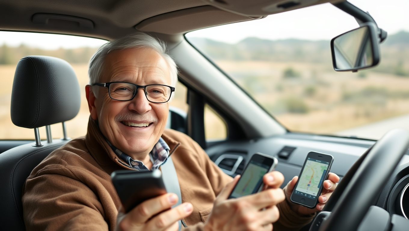
New research shows that Sat Nav systems are helping keep older drivers on the roads for longer. The study reveals that over 65s with a poorer sense of direction rely more on help from GPS navigation systems such as Sat Nav or smartphone maps. Those using GPS tended to drive more frequently — suggesting that the technology helps older people maintain driving independence.
Avatar photo

Published

on

The article begins by highlighting the importance of driving for older adults, particularly in maintaining their independence, quality of life, and cognitive health. However, age-related cognitive decline can impair spatial abilities, leading to reduced driving frequency. New research from the University of East Anglia reveals that over 65s with a poorer sense of direction rely more on GPS navigation systems like Sat Nav or smartphone maps.

The study, which involved 895 UK drivers aged over 65, found that using GPS tended to drive more frequently than those who did not use it. This suggests that the technology helps mitigate against spatial orientation difficulties and maintain driving mobility. The research also showed that older people with a poorer sense of direction rely more on Sat Navs.

Lead author Dr Sol Morrissey noted that using a Sat Nav system can alleviate the cognitive demands of navigation when driving, particularly when visiting less familiar destinations. This technology has become increasingly popular among older drivers.

The team worked with participants to understand how they use GPS and its impact on their driving mobility and cognitive performance. They found that a considerable majority of older drivers use navigation assistance at least for some journeys, commonly for the entire journey to a new destination.

Senior author Prof Michael Hornberger emphasized the importance of understanding factors that keep older people on the roads safely for longer. He noted that supporting older drivers with using GPS navigation could really help maintain their driving independence.

This research was led by UEA in collaboration with several universities and funded by the Department for Transport. The study is supported by the National Institute of Health and Care Research (NIHR) Applied Research Collaboration (ARC) East of England.

Automotive and Transportation

“Mapping Safer Bike Routes with ProxiCycle: A Small Sensor’s Big Impact”

Researchers have developed a system, called ProxiCycle, that logs when a passing car comes too close to a cyclist (four feet or less). A small, inexpensive sensor plugs into bicycle handlebars and tracks the passes, sending them to the rider’s phone. The team tested the system for two months with 15 cyclists in Seattle and found a significant correlation between the locations of close passes and other indicators of poor safety, such as collisions.

Avatar photo

Published

on

By

The University of Washington-led team has developed a system called ProxiCycle that logs when a passing car comes too close to a cyclist (within four feet). This small, inexpensive sensor plugs into bicycle handlebars and tracks the passes, sending them to the rider’s phone. The team tested the system for two months with 15 cyclists in Seattle and found a significant correlation between the locations of close passes and other indicators of poor safety, such as collisions.

“The threat of cars is the biggest deterrent to cycling,” said lead author Joseph Breda, a UW doctoral student in the Paul G. Allen School of Computer Science & Engineering. “We want to help novice cyclists navigate safer bike routes through cities.”

The team surveyed 389 people in Seattle and found that respondents of all cycling experience levels ranked the threat of cars as the factor which most discouraged them from cycling. They also said they’d be very likely to use a map that helps navigate for safety.

To create ProxiCycle, the team built a small sensor system that plugs into a bike’s left handlebar. The system consists of a 3D printed plastic casing that houses a pair of sensors and a Bluetooth antenna. The antenna transmits data to the rider’s phone, where the team’s algorithm susses out what’s a passing car rather than a person, or another cyclist, or a tree.

The team validated the system both by testing it in a parking lot, with a car passing at different distances, and with seven cyclists riding through Seattle with GoPro cameras on their handlebars. Researchers watched the footage from these rides and compared this to the sensor output.

In the future, researchers hope to scale the study up and potentially account for other risk factors, such as cyclists being hit by opening car doors, and deploy ProxiCylce in other cities. With enough data, existing bike mapping apps might include safer route suggestions for cyclists.

“One study participant found out that there’s a great bike lane on a quieter street just one block north,” said Breda. “It’s these minor adjustments that can make a big difference in safety.”

Continue Reading

Automotive and Transportation

Soft Wire Act: Revolutionary Robot Can Carry Cargo Up and Down Steep Aerial Wires

Researchers have created a light-powered soft robot that can carry loads through the air along established tracks, similar to cable cars or aerial trams. The soft robot operates autonomously, can climb slopes at angles of up to 80 degrees, and can carry loads up to 12 times its weight.

Avatar photo

Published

on

By

In a groundbreaking innovation, researchers have designed a light-powered soft robot that can carry loads through the air along established tracks, similar to cable cars or aerial trams. This autonomous soft robot, made of liquid crystal elastomers, can climb slopes at angles of up to 80 degrees and carry loads up to 12 times its weight.

According to Jie Yin, corresponding author of a paper on the work and an associate professor of mechanical and aerospace engineering at North Carolina State University, “We’ve previously created soft robots that can move quickly through water and across solid ground. Now, we’ve demonstrated that it’s possible to carry objects through the air across open space by following established tracks.”

The soft robot operates by being suspended on a track, which can be as thin as a human hair or as thick as a drinking straw. When exposed to infrared light perpendicular to the track, the portion of the ribbon absorbing the most light contracts, inducing a rolling motion that pulls the “cooler” part into the light. This cycle repeats itself over and over again, causing the soft ring robot to roll and twist on itself as it moves along the track.

“We’ve also shown that our soft ring robot can overcome obstacles on the track, such as knots or bulges,” says Fangjie Qi, first author of the paper and a Ph.D. student at NC State. “It can travel up or down a slope and carry loads more than 12 times its weight.”

In addition to navigating tracks of varying thickness, the researchers demonstrated that the soft robot can follow complex routes, including curved lines, circles, three-dimensional spirals, and so on, in a controlled way.

The team is now exploring specific applications for this technology, as well as adapting the soft robots to respond to inputs other than infrared light. “For example,” says Yin, “we’re thinking about developing a soft ring robot that operates in sunlight or responds to other external energy sources.”

Continue Reading

Artificial Intelligence

Clear Navigation: Explainable AI for Ship Safety Raises Trust and Decreases Human Error

A team has developed an explainable AI model for automatic collision avoidance between ships.

Avatar photo

Published

on

By

The sinking of the Titanic 113 years ago was a tragic reminder of the importance of accurate navigation. The ship’s encounter with an iceberg led to one of the most infamous maritime disasters in history, and human error likely played a significant role. Today, autonomous systems powered by artificial intelligence (AI) are being developed to help ships avoid such accidents. However, for these systems to be widely adopted, it is crucial that they can provide transparent explanations for their actions.

Researchers from Osaka Metropolitan University’s Graduate School of Engineering have made a significant breakthrough in this area. They have created an explainable AI model specifically designed for ship navigation, which quantifies the collision risk for all vessels in a given area. This feature is particularly important as key sea-lanes have become increasingly congested, making it more challenging to ensure safe passage.

The researchers, Graduate Student Hitoshi Yoshioka and Professor Hirotada Hashimoto, aimed to develop an AI model that not only makes informed decisions but also provides clear explanations for its actions. By using numerical values to express the collision risk, the system can communicate its reasoning to the captain, enabling them to make more informed decisions.

According to Professor Hashimoto, “By being able to explain the basis for the judgments and behavioral intentions of AI-based autonomous ship navigation, I think we can earn the trust of maritime workers. I also believe that this research can contribute to the realization of unmanned ships.”

The findings of this study have been published in Applied Ocean Research, highlighting the potential for explainable AI to improve ship safety and reduce human error. As the maritime industry continues to evolve, the development of transparent and trustworthy autonomous systems will be essential for ensuring safe and efficient navigation.

Continue Reading

Trending