
While we try to keep things accurate, this content is part of an ongoing experiment and may not always be reliable.
Please double-check important details — we’re not responsible for how the information is used.
Early Climate
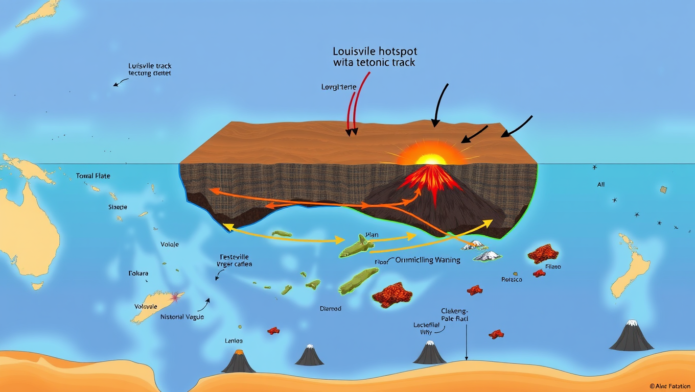
Unveiling the Ancient Secrets of the Pacific Ocean: A Breakthrough in Understanding Earth’s Volcanic History
A new study traces a 120-million-year-old ‘super-eruption’ to its source, offering new insights into Earth’s complex geological history.


Early Climate
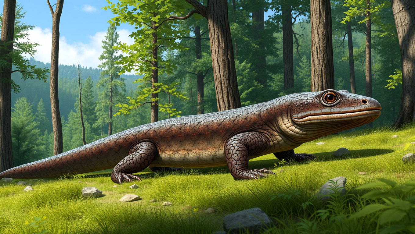
Uncovering Appalachia’s Ancient Past: The Discovery of a Monster Salamander in Tennessee
A massive, extinct salamander with jaws like a vice once roamed ancient Tennessee and its fossil has just rewritten what we thought we knew about Appalachian amphibians. Named Dynamognathus robertsoni, this powerful predator wasn t just a curiosity; it may have sparked an evolutionary chain reaction, shaping the region s remarkably diverse salamander population. Once thought to be isolated to southern Alabama, salamanders like this one were clearly far more widespread and potentially far more influential than previously believed. And it all began with a volunteer sifting through tons of dirt near East Tennessee State University.
Ancient Civilizations
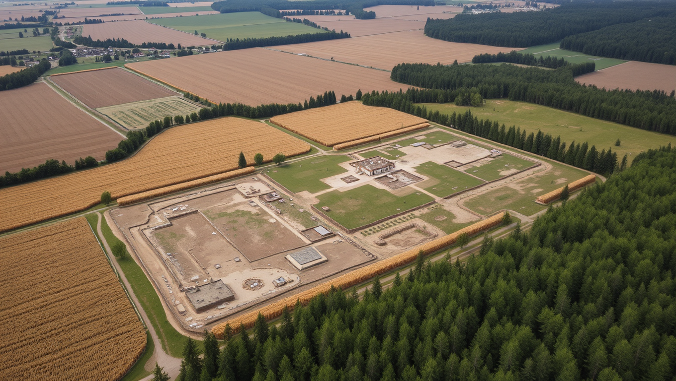
Uncovering Ancient Native American Farms in Michigan: A Drone-Based Study Reveals 1,000-Year-Old Farming System
In the dense forests of Michigan s Upper Peninsula, archaeologists have uncovered a massive ancient agricultural system that rewrites what we thought we knew about Native American farming. Dating back as far as the 10th century, the raised ridged fields built by the ancestors of the Menominee Indian Tribe covered a vast area and were used for cultivating staple crops like corn and squash. Using drone-mounted lidar and excavations, researchers found evidence of a complex and labor-intensive system, defying the stereotype that small, egalitarian societies lacked such agricultural sophistication. Alongside farming ridges, they also discovered burial mounds, dance rings, and possible colonial-era foundations, hinting at a once-thriving cultural landscape previously obscured by forest.

Ancient Civilizations
Uncovering Hidden Secrets: A 3,500-Year-Old Cemetery Reveals New Insights into Bronze Age History
Bronze Age life changed radically around 1500 BC in Central Europe. New research reveals diets narrowed, millet was introduced, migration slowed, and social systems became looser challenging old ideas about nomadic Tumulus culture herders.

A New Horizon for Vision: How Gold Nanoparticles May Restore People’s Sight

Retiring Abroad Can Be Lonely Business

Revolutionizing Quantum Communication: Direct Connections Between Multiple Processors
Harnessing Water Waves: A Breakthrough in Controlling Floating Objects

“Unveiling Hidden Patterns: A New Twist on Interference Phenomena”

Household Electricity Three Times More Expensive Than Upcoming ‘Eco-Friendly’ Aviation E-Fuels, Study Reveals
Reducing Falls Among Elderly Women with Polypharmacy through Exercise Intervention
-
 Detectors12 months ago
A New Horizon for Vision: How Gold Nanoparticles May Restore People’s Sight
-
Earth & Climate1 year ago
Retiring Abroad Can Be Lonely Business
-
Cancer1 year ago
Revolutionizing Quantum Communication: Direct Connections Between Multiple Processors
-
Albert Einstein1 year ago
Harnessing Water Waves: A Breakthrough in Controlling Floating Objects
-
Chemistry1 year ago
“Unveiling Hidden Patterns: A New Twist on Interference Phenomena”
-
Earth & Climate1 year ago
Household Electricity Three Times More Expensive Than Upcoming ‘Eco-Friendly’ Aviation E-Fuels, Study Reveals
-
Diseases and Conditions1 year ago
Reducing Falls Among Elderly Women with Polypharmacy through Exercise Intervention
-
Agriculture and Food1 year ago
“A Sustainable Solution: Researchers Create Hybrid Cheese with 25% Pea Protein”